Let's control vector-borne disease.
VectorSurv helps public health agencies manage surveillance data, visualize trends, and make real-time decisions to prevent the spread of vector-borne diseases and protect public health.
VectorSurv Gateway
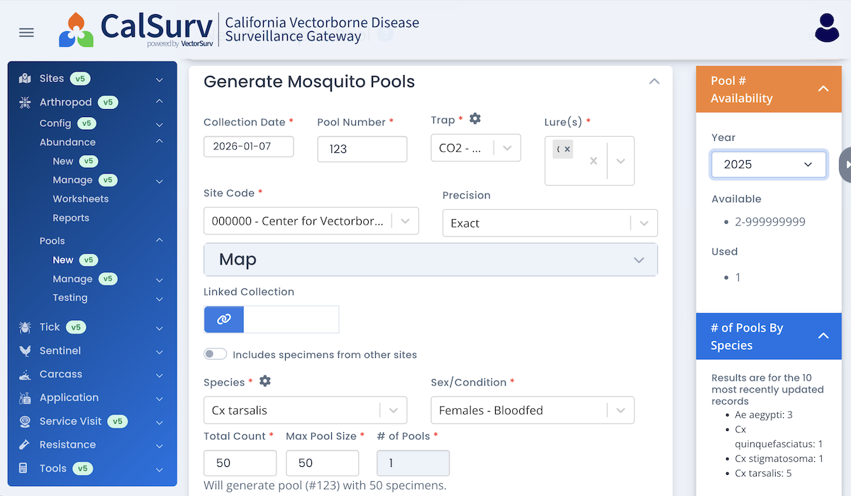
Vector control and public health agencies use the Gateway to manage and analyze surveillance and control data. Each agency maintains all privileges to manage its own data and user accounts.
VectorSurv Maps
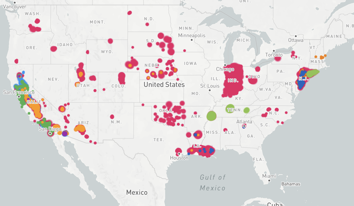
Shows past and present results of surveillance for arboviruses and invasive mosquitoes. Users with a Gateway login can also visualize abundance, insecticide resistance, and West Nile Virus risk.
VectorSurv API
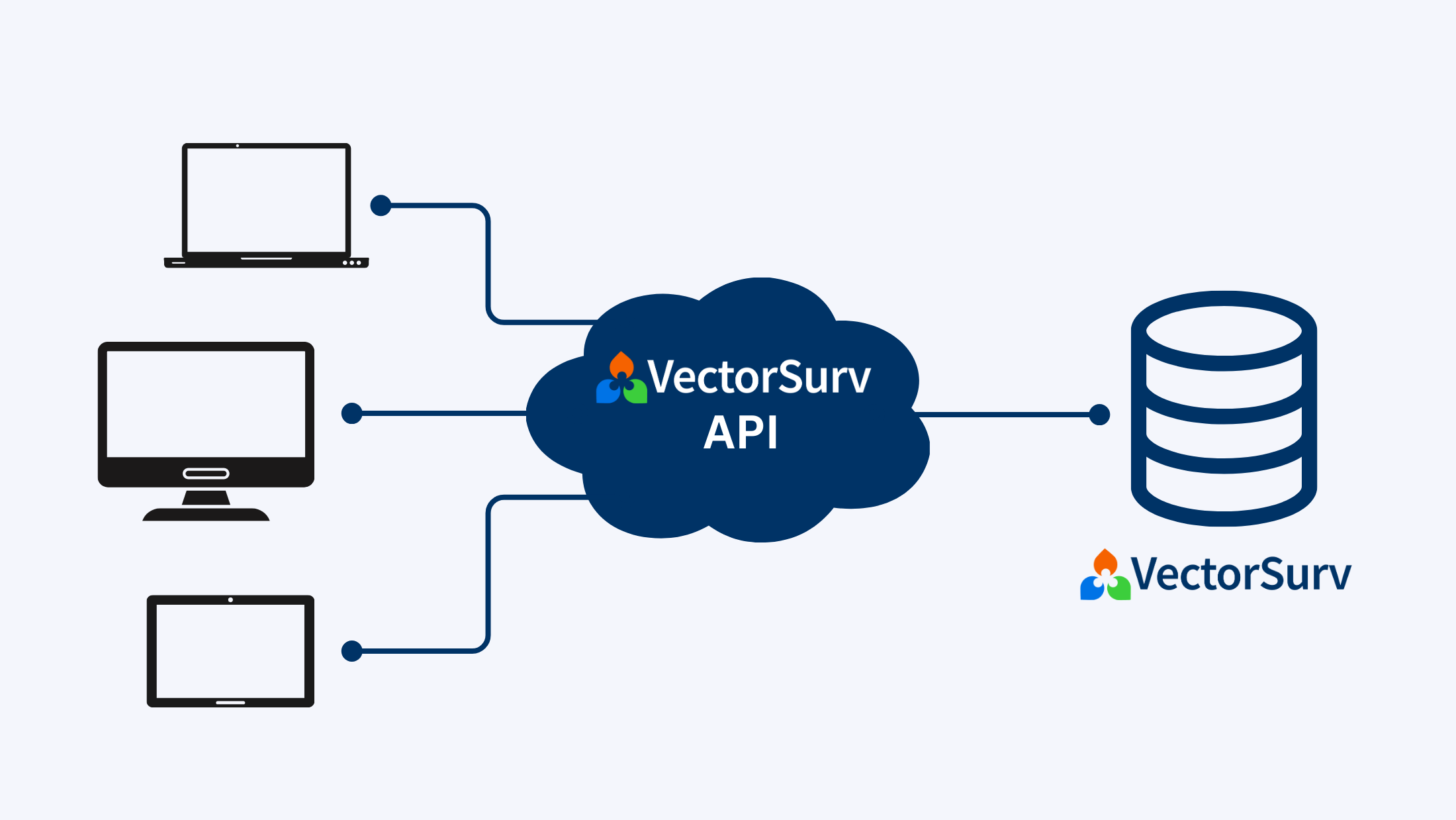
Integrate VectorSurv with other software using the VectorSurv API. Our RESTful API provides a way for you to use your VectorSurv data in other software applications.
Join our newsletter to stay up to date with announcements, new features, tips, and more.
Our impact:

36
states and territories

390+
agencies

1300+
users
We have users in:
California
Colorado
Delaware
New Jersey
New Mexico
New York
US-Affiliated Pacific Islands
- Pacific Island Health Officers Association
- Guam
- Republic of Palau
- Commonwealth of the Northern Mariana Islands
- Federated States of Micronesia
- Republic of the Marshall Islands
How we work:
VectorSurv works closely with state and local agencies and the U.S. Centers for Disease Control and Prevention, Division of Vector-Borne Diseases to facilitate real time analytics and sharing that informs decision makers at all levels from local to federal, including easy reporting to ArboNet.
VectorSurv is made possible by the collaboration and input of our partner agencies and by grants received from the funding partners over the years since we first launched the system in 2006.